NONESUCH
EXPEDITIONS FOUNDED
IN 1962
Vilcabamba
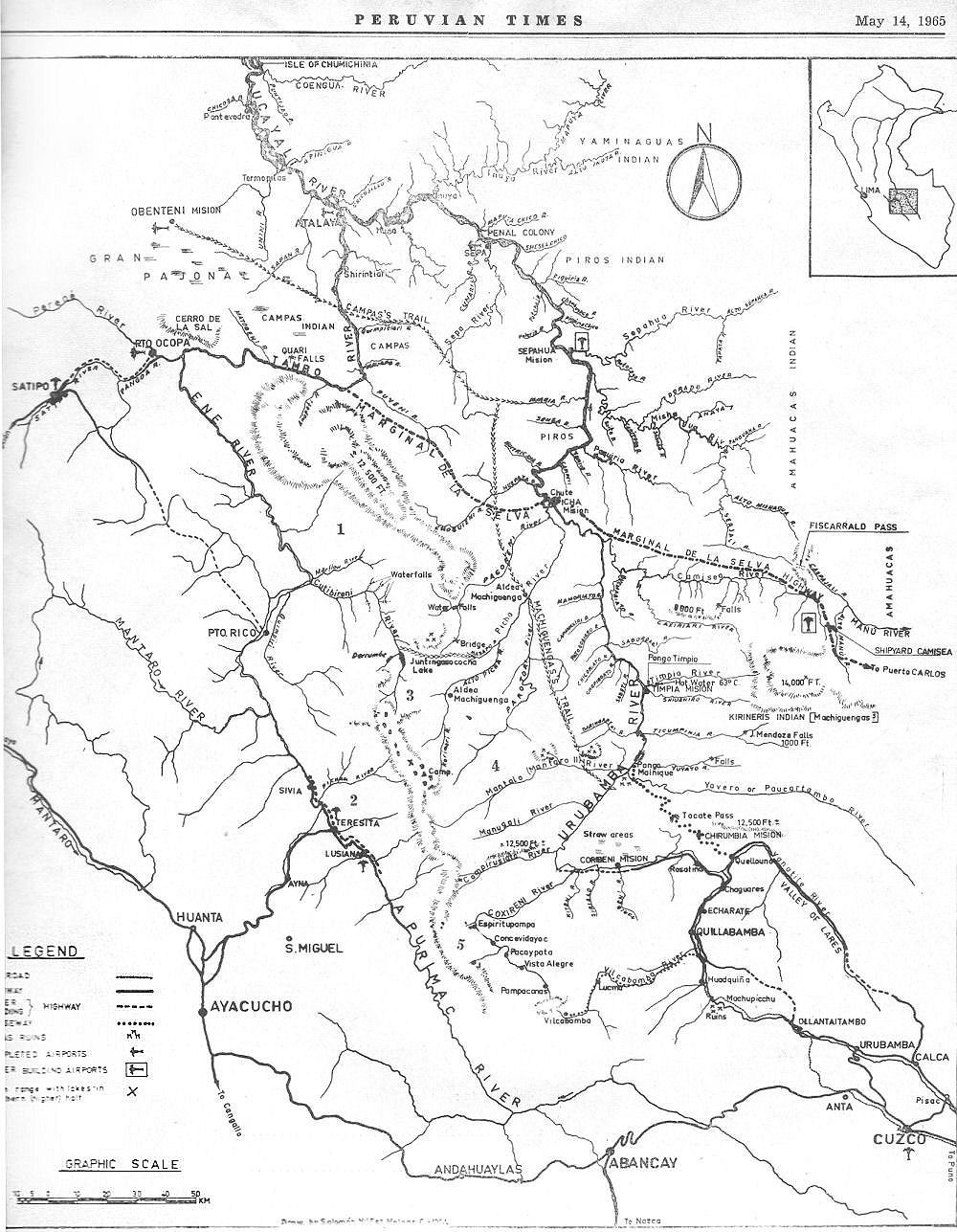
cordillera - map from 1965 | ||||||||
| Reproduced by courtesy of the Peruvian Times, Lima, Peru - it covers the cordillera between the Apurimac and Urubamba rivers to the northeast of Cuzco | ||||||||
| This map accompanied many Peruvian Times reports of the late 1960s— an era of exploration, road building and a focus on the area. At that time this wilderness was known as PeruVia - the new centre of Peru - it was a planner's dream that never materialised | ||||||||
One major project was the Marginal Highway - the Marginal de la Selva intended to cut through virgin montane rainforest in the eastern Andes. Some parts were completed but it was largely dropped. Nicholas Asheshov's route to the Pichari river and into the cordillera began in Luisiana [Here as Lusiana ] on the Apurimac river. Please remember this map was made in 1965 and the data avilable then was not always perfect
| ||||||||
| Please use your browser to zoom | ||||||||
 | ||||||||
|