|
| Yguazú
- from the Tupi Guarani language family |
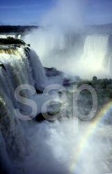
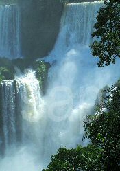
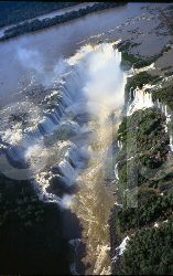
The Iguazú Falls from the Argentinian side | Cataratas
do Iguaçú - Brasilian name | ||||||||||
|
Cataratas
del Iguazú - Argentinian name | Iguassú
- older Portuguese | |||||||||||
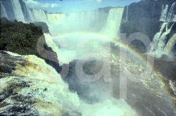
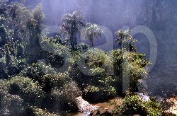
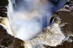
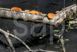
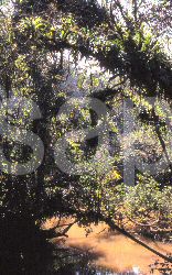
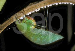
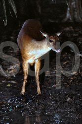
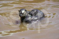
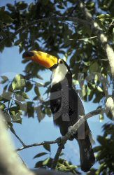
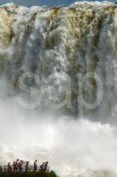
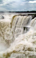
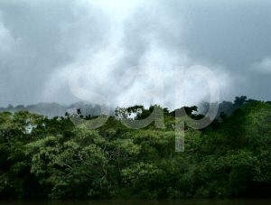
| .... With an average height of 72m / 236 ft across a river's edge 2.7kms /1.6 miles wide and with at least three names they are greater than Niagara. In some dry seasons there are as many as three hundred separate falls and in flood times there are as few as three. They lie within two national parks in subtropical forest filled with countless birds and butterflies. Many mammals including jaguars, giant otters, coatis and bush dogs live in places off the beaten track. The falls are a UNESCO World Heritage Site and and one of South America's greatest natural spectacles. | ||||||||||||
|
Photos and text by Tony and Marion Morrison | ||||||||||||
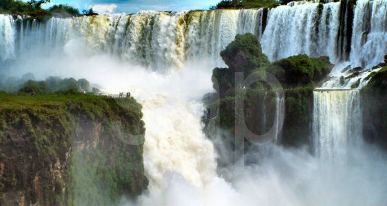 | ||||||||||||
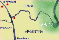
| These remarkable falls on the border of Argentina and Brasil approximately 550 km / 340 miles inland from the Atlantic ocean and named after the river they dominate. The name varies according to the various local languages though the same suffix or ending azú, assú or açu is used. It is derived from Tupi Guarani the original language family of the area and means 'big'. The falls comprise roughly 300 falls. Below the falls the river races through a narrow gorge before entering the River Parana the major tributary of the River Plate. The falls were were discovered early in 1542 by a Spanish commander Álvar Núñez Cabeza de Vaca and were declared a World Heritage Site in 1984 and 1986 The falls lie within the boundaries of two National Parks - one Argentinian and the other Brasilian. | ||||||||||||
| ||||||||||||
| ||||||||||||
| THE DISCOVERY By 1542 Spanish and Portuguese explorers were getting to know their way around South America. Ten years earlier over on the Pacific coast Francisco Pizarro had found his way in to the Inca Empire. On the Atlantic coast the mouth of the Amazon was discovered by a Spaniard in January 1500 and soon Portuguese traders began small settlements for collecting a richly coloured 'brazil wood' from the forests.The name comes from the Latin 'brasile' meaning red. Meanwhile the River Plate from the Spanish word plata meaning silver attracted explorers trying to find a way to a land they believed was rich with the precious metal. One expedition left Seville in Spain in 1535 and headed for the River Plate. The adventurers set up a base near the site of present day Buenos Aires and exploratory groups were despatched inland. One commanded by a Spaniard Juan de Salazar went up the river Parana and then to the River Paraguay where his men built a stockade they called Asunción. Back at base the leader of the main group fell ill and decided to return to Spain. He died at sea and when news of his death and the isolated garrison at Asunción reached Spain a relief expedition was sent out. The commander Álvar Núñez Cabeza de Vaca was a travel-hardened Spaniard from the city of Jerez de la Frontera in southwestern Spain. He had already made his name by exploring Florida, parts of Texas and some of Mexico between 1528 / 36. Álvar Núñez eached Santa Catalina Island [now Santa Catarina] on the coast of Brasil late in 1541 and decided to strike boldly inland at roughly the right latitude to reach Asunción overland. In late 1541 Álvar Núñez set out with two hundred and fifty men and twenty six horses from close to where the city of Florianopolis stands today.
They were the first Europeans to give an account of the falls. * references from written accounts and translations 1555 - 1567 - 1891
| ||||||||||||
| MANY FALLS | ||||||||||||
| ||||||||||||
| THE NATIONAL PARKS Bienvenido - Bem vindo! | ||||||||||||
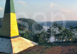
| ARGENTINA Parque Nacional Iguazú - Misiones Province Argentina | ||||||||||||
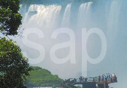
| The park was created in 1934 and covers 55,000 hectares. In 1984 it was named by UNESCO as a World Heritage Site. The park entrance is xx kms by road from Puerto Iguazú. From the Visitor Centre at the entrance to the park a mini-railway takes a route into the forest with stops at a Cataratas station for many of the falls and walks beside the river. The train continues to the Devil's Throat station where another walk at a higher level leads above one of the most spectacular falls | 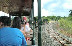 | |||||||||||
| BRASIL Parque Nacional do Iguaçú, - State of Paraná, Brasil | ||||||||||||
| The park was created in 1939 and covers 185,000 hectares .In 1986 it was named by UNESCO as a World Heritage Site . The entrance is xx kms by road from Foz do Iguacu. From a visitor centre at the entrance to the park luxury omnibuses make the journey to the forested edge of the falls. An observation tower stands beside the largest fall and below and at the water's edge walkways extend over the river to even more falls. | 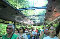 | |||||||||||
| Which side is best? Both can be visited easily in one day and both are wonderful. To see much of the wildlife a longer stay is needed with arrangements to trek deeper into the parks. | ||||||||||||
| ||||||||||||
 expedition headed into an incredible wilderness of low mountains - the Serra
do Mar, dense forests and huge rivers. The Spaniards had no idea of the kind
of reception they would meet from the indigenous,Tupi Guarini native population,
Reports from friendly people along the way were good and they found the headwaters
of the Yguazú river and followed it westward downstream. Some of the explorers
used canoes and others travelled by land. In January 1542 the reached the falls.....'
The current of the Yguazú was so that the canoes were carried furiously
down river, for near this spot there is a considerable fall and the noise made
by the water leaping down some high rocks into a chasm may be heard a great distance
off and the spray rises two spears high and more over the fall....
*
expedition headed into an incredible wilderness of low mountains - the Serra
do Mar, dense forests and huge rivers. The Spaniards had no idea of the kind
of reception they would meet from the indigenous,Tupi Guarini native population,
Reports from friendly people along the way were good and they found the headwaters
of the Yguazú river and followed it westward downstream. Some of the explorers
used canoes and others travelled by land. In January 1542 the reached the falls.....'
The current of the Yguazú was so that the canoes were carried furiously
down river, for near this spot there is a considerable fall and the noise made
by the water leaping down some high rocks into a chasm may be heard a great distance
off and the spray rises two spears high and more over the fall....
*